Purva Heron Connectivity
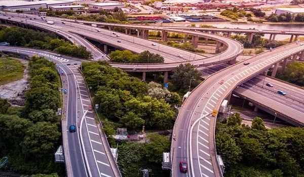
Purva Heron connectivity centres on Tumkur Road (NH 48), Green Line Metro access through Nagasandra and road links towards Peenya, Jalahalli and Yeshwanthpur. Located in Mallasandra, North-West Bangalore, the project’s indicative location details place Jalahalli Cross around 4–6 km away, Peenya Industrial Area 5–8 km away and Yeshwanthpur 6–9 km away. Distances vary with the destination and approach road.
For wider travel, NICE Road connects the Tumkur Road corridor with western and southern Bangalore. The Green Line offers another way to reach Yeshwanthpur, Rajajinagar and Majestic. Together, these links give Purva Heron residents options for work trips, shopping and intercity travel without depending on one road.
Tumkur Road Connectivity From Purva Heron
Purva Heron is planned off Tumkur Road, the highway corridor linking Bangalore with Nelamangala and Tumakuru. City-bound travel follows the route towards the Peenya and Yeshwanthpur belt, while outward journeys head towards Nelamangala.
For a daily commute, the approach to the highway matters as much as the distance. Service-road access, available turns and U-turn locations can affect the journey. During a site visit, check both the route leaving the project and the return route to its entrance.
Nagasandra Metro and Green Line Access
Nagasandra Metro is the main station reference in Purva Heron’s location details. It lies on the operational Green Line, which now extends farther northwest to Madavara. The Nagasandra–Madavara extension is open for public service.
From Nagasandra, city-bound Green Line trains serve Peenya, Yeshwanthpur, Rajajinagar and Majestic. This can be useful for commuters whose workplaces sit near a station.
For MG Road, change to the Purple Line at Majestic. The journey is not a direct Green Line ride. Include travel from the apartment to Nagasandra, station entry and the interchange when planning your full commute.
Distance to Peenya, Jalahalli and Yeshwanthpur
The project’s indicative distance bands place Peenya Industrial Area about 5–8 km away. Peenya covers a large area, so the route to a factory gate or office building can differ from the route to the locality’s general map pin.
Jalahalli Cross is approximately 4–6 km away, while Yeshwanthpur is around 6–9 km away. These are useful starting points for checking access to employment areas, shops and transport connections.
For buyers working in these areas, test the journey during the usual shift or office hours. A short distance can still involve a busy junction, especially where local traffic meets the highway.
Yeshwanthpur Railway Station and Majestic
Yeshwanthpur Junction provides access to intercity rail services from the northwestern side of Bangalore. Use the railway station’s entrance as your destination when planning a train journey; the distance to Yeshwanthpur locality is not the same as the distance to a station gate.
The project details place Majestic approximately 12–15 km away by road. It is also reachable on the Green Line from Nagasandra, giving residents a rail option for trips towards central Bangalore.
For an early train or bus, allow time for the final approach, parking and walking to the platform or boarding point.
NICE Road Access to South and West Bangalore
NICE Road provides a peripheral route between Tumkur Road and Hosur Road. Its approximately 41 km main corridor also connects with major roads serving western and southern Bangalore. For Purva Heron residents, this offers an alternative for journeys towards Mysore Road, Kanakapura Road, Bannerghatta Road and Electronic City. It can avoid a route through the city centre, though it may involve a longer drive and toll charges.
Choose the route based on the destination and live traffic. A peripheral road is useful for cross-city travel, but it will not be the shortest option for every trip.
Shopping and Healthcare Connections
Orion Mall at Brigade Gateway is approximately 9–12 km away, according to the project’s indicative location information. The Yeshwanthpur and Rajajinagar belt also provides access to shops, dining and other services.
For healthcare, the surrounding corridor includes hospitals in the Jalahalli, Peenya and Yeshwanthpur areas. Check the route to the hospital you use rather than relying only on a neighbourhood name.
Daily needs deserve a separate check during your visit. Look at the route to nearby groceries, pharmacies and school pickup points, including whether you need to cross the highway.
Airport Travel From Mallasandra
Purva Heron’s airport journey requires a road connection from the Mallasandra–Tumkur Road area towards the NH 44 airport corridor. The suitable route depends on traffic and the available connecting roads.
For flight planning, enter the correct Kempegowda International Airport terminal. Include time for the terminal approach and airline check-in. Airport travel should be assessed separately from the shorter Peenya or Yeshwanthpur commute.
Planned Peripheral Ring Road Connectivity
The proposed Peripheral Ring Road is intended to connect the Tumkur Road side with several northern and eastern roads before reaching the Hosur Road corridor. Government project material identifies links with Bellary Road, Hennur–Bagalur Road, Old Madras Road and other major routes.
This is a future connection, separate from the operational NICE Road. Purva Heron’s present connectivity rests on existing roads and Metro services. Any benefit from the new ring road will depend on its completion and the location of usable entry points.
FAQs
Purva Heron has access to the Tumkur Road corridor, Nagasandra Green Line Metro and routes towards Peenya, Jalahalli and Yeshwanthpur. NICE Road supports longer trips towards western and southern Bangalore.
Nagasandra is the Metro station identified in the project's location details. Check the route from the project entrance to the station during your visit.
The indicative distance is 5–8 km, depending on the factory, office or industrial phase.
Yes. Take the Green Line towards Majestic, then change to the Purple Line towards MG Road.
No. It is a planned infrastructure link. NICE Road is the existing peripheral road serving the Tumkur Road corridor.